![]()
Satellite image browsing history, new channels view and better sharing.
Organise, save and share. As the first update of 2021, we bring to you a new way to handle your observations, make it easier to share what you see and automatically store your browsing history for later. Saving observation state From now on when you’re working on your observations, all changes and settings will be…
![]()
How to download the latest satellite images?
Although we do our best to simplify taking images from satellites to be as easy as taking them from your smartphone, there is a couple of differences worth learning before you start working with space-based data. TL;DR For those who simply want a quick tutorial on how to get the most up to date satellite…
![]()
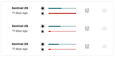
One last thing before 2021 – new features and improvements to prepare for what’s coming next!
Before you pop your champagne bottle, saying goodbye to a very – well, let’s just say, peculiar year – check out new features prepared for you as the last upgrade in 2020. Area coverage and visibility bars for quick filtering To make it easier for you to find the right imagery, we’ve added…
![]()
Increased free API limit, satellite acquisition plan viewer improvements and more!
It’s difficult to prototype new ideas without the right tools that would allow us to focus only on the most important things. For this reason, we’ve decided to increase the daily limit on our API usage. We hope this will make it even easier for you to create and share awesome knowledge built based on satellite…
![]()
Trending areas and a calendar for satellite overpasses – the October update released!
What’s new? In case you were wondering what are the hottest locations for satellite monitoring recently – we got you covered! We have just released a new version of the app, which includes an option to display trending areas all around the world. We hope this will help when trying to stay up-to-date with the…
![]()
Satellite overpasses and imagery notifications – a new version of spectator.earth is out!
What’s new? Spectator allows you to track satellites, access their imagery and easily build new information, based on data from this amazing orbital infrastructure. However, as you grow your collection of observations, it’s becoming more and more difficult to track what’s happening in all of your areas of interest. We know it, you know it,…
![]()
Tajemnicze obiekty na zdjęciach satelitarnych – znaleziska z przeszłości, fake newsy i sensacje z przypadku
Jakie tajemnice odkryto dzięki obrazowaniom satelitarnym? Czy dzięki nim niektóre z niewyjaśnionych dotąd spraw kryminalnych rzeczywiście doczekają się rozwiązania?
![]()
Wojna widziana z satelity – jak wygląda naprawdę?
Rozwój obserwacji Ziemi z orbity od początku związany był z działaniami militarnymi. Nie inaczej jest dzisiaj. Dzięki obrazowaniom satelitarnym można zapobiec m.in. atakom wojskowych sił lądowych. Jak prowadzenie działań zbrojnych przez satelitę wygląda w praktyce?
![]()
Piękno z orbity. Najładniejsze widoki Ziemi, które można zobaczyć tylko na zdjęciach satelitarnych
Jakie wyjątkowe zakątki Ziemi można zobaczyć na zdjęciach satelitarnych? Zobacz subiektywny ranking najpiękniejszych lokalizacji!
![]()
Jak firmy ubezpieczeniowe korzystają z obrazowań satelitarnych?
Z bezpłatnych danych satelitarnych korzystają nie tylko rolnicy, ale także firmy ubezpieczeniowe. Jak w praktyce działa szacowanie szkód z poziomu orbity?