Top satellite-based observations of spring 2023
Highlights of the most interesting satellite-based observations from spring 2023
As we transitioned from the chilly winter to the blooming spring of 2023, the world’s satellites have been hard at work, capturing stunning and insightful observations of our planet. From the devastating effects of wildfires and flooding to the awe-inspiring beauty of our changing environment, these top satellite-based observations are a great example of the power and importance of technology in understanding and preserving our planet.
International Days
Earth Day Celebration and Worlds Water Day Celebration
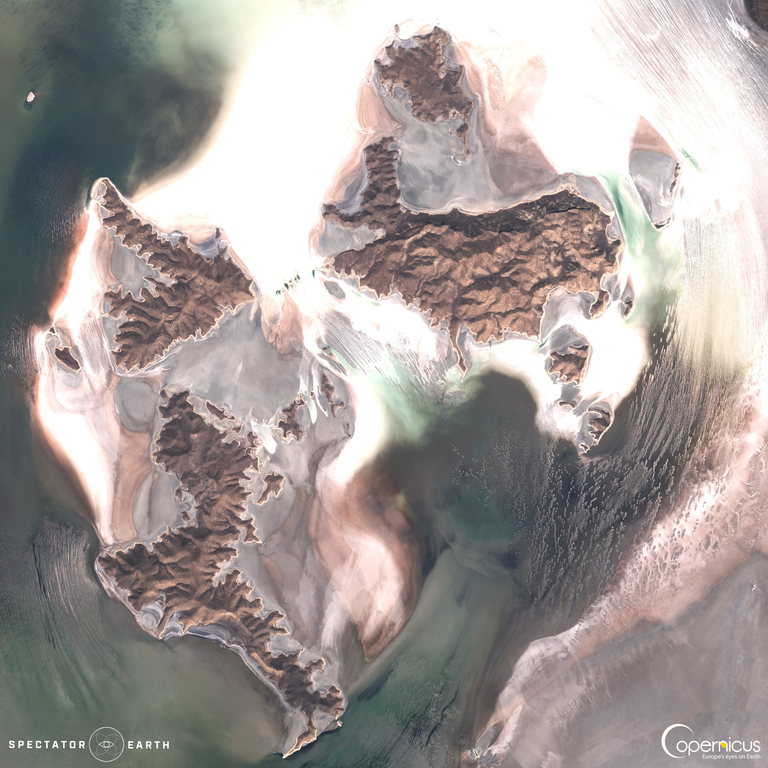
International Earth and Water Days are celebrated annually to raise awareness about the importance of these resources. Below you can find a stunning satellite image of Lake Urmia, a reminder of the importance of preserving our natural resources.
Wildfires
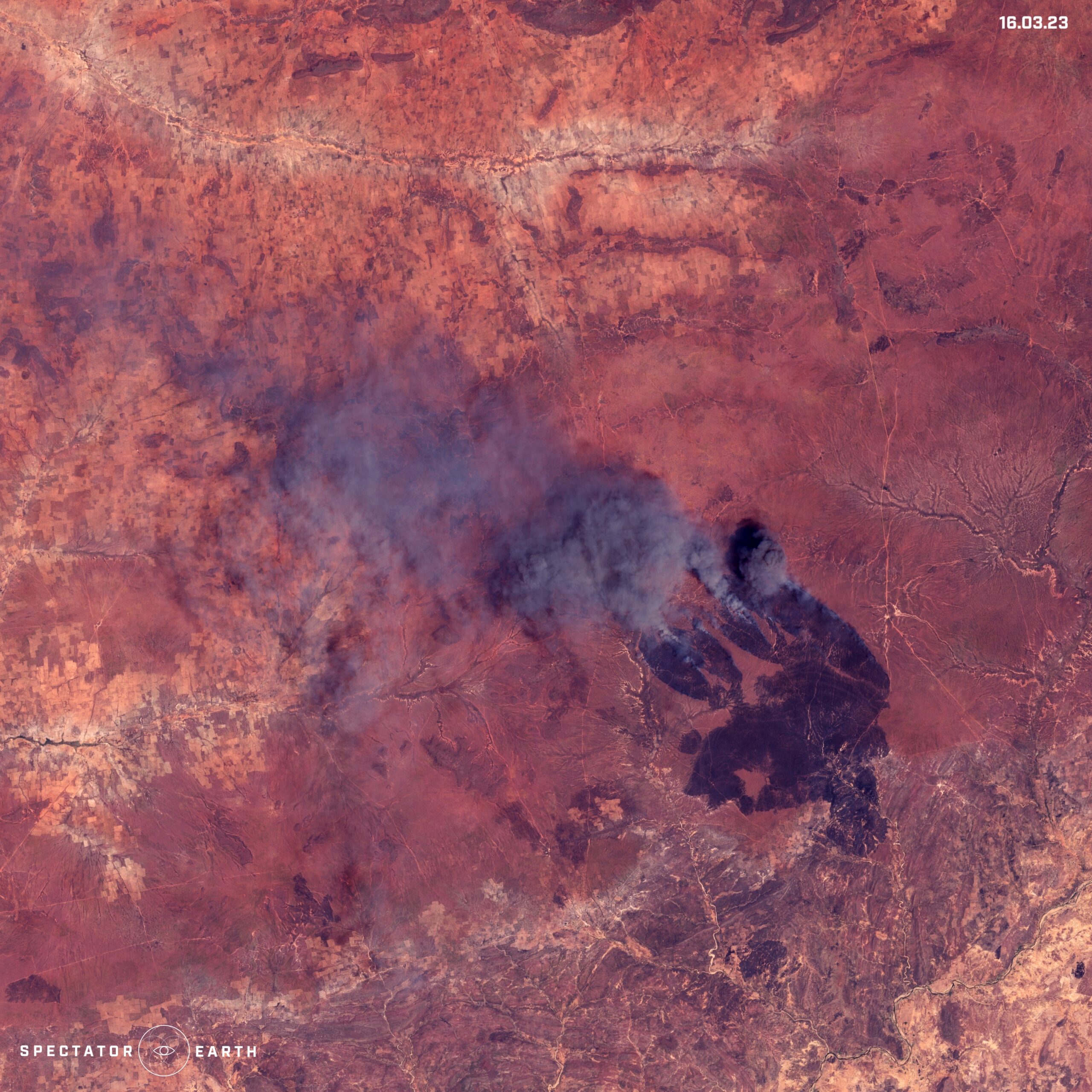
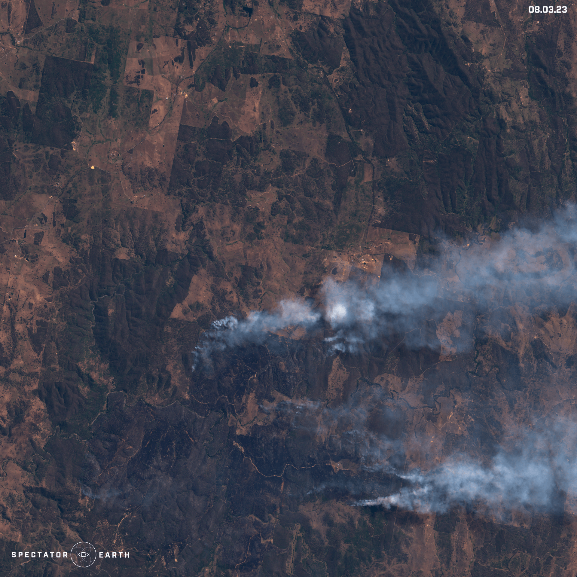
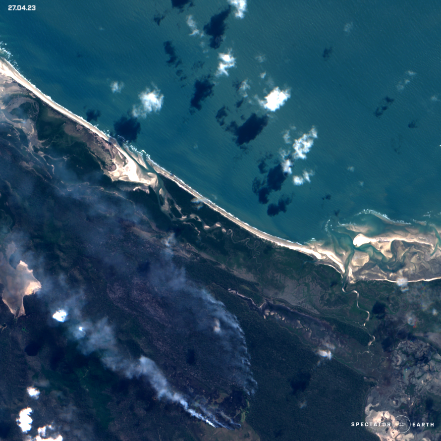
One of the most significant events in recent times has been the increase in wildfires across the globe. Satellites are being used to track the spread of these fires, predict their paths, and assess their impact on the environment. This information is being used to develop strategies to prevent future fires and to mitigate their effects. If you have a keen interest in local news and want to stay informed about environmental events, monitoring wildfire events in areas near your location could be a worthwhile pursuit, even if you do not require information about wildfires on a global scale.
The notable occurring wildfires during this spring are:
- Wildfire spotted in Camp Island, Australia.
- Fire in Alakol District in Kazakhstan.
- Wildfire spotted in Sangi, Nigeria.
- Australian fire in Tambaroora.
Floods
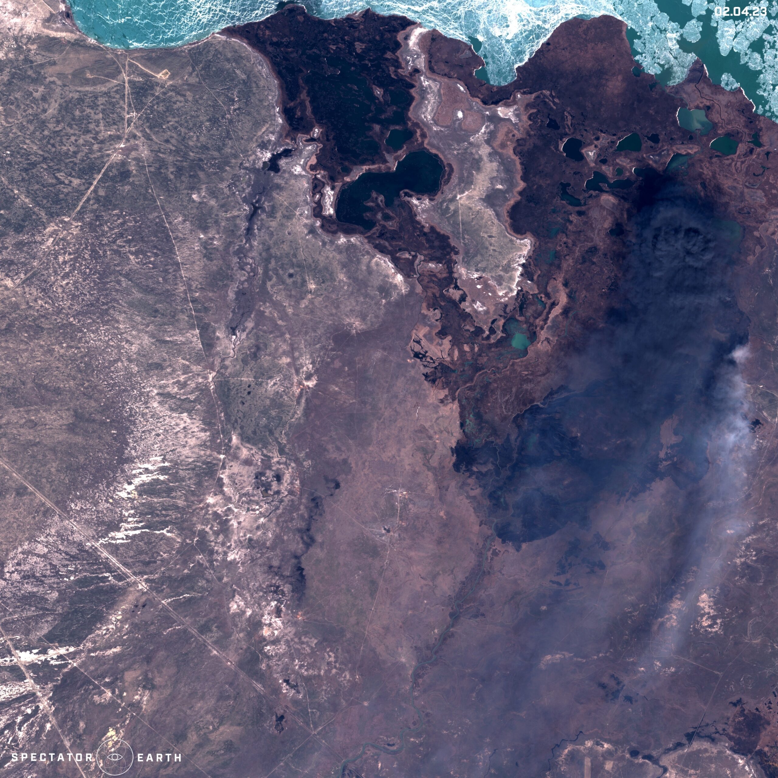
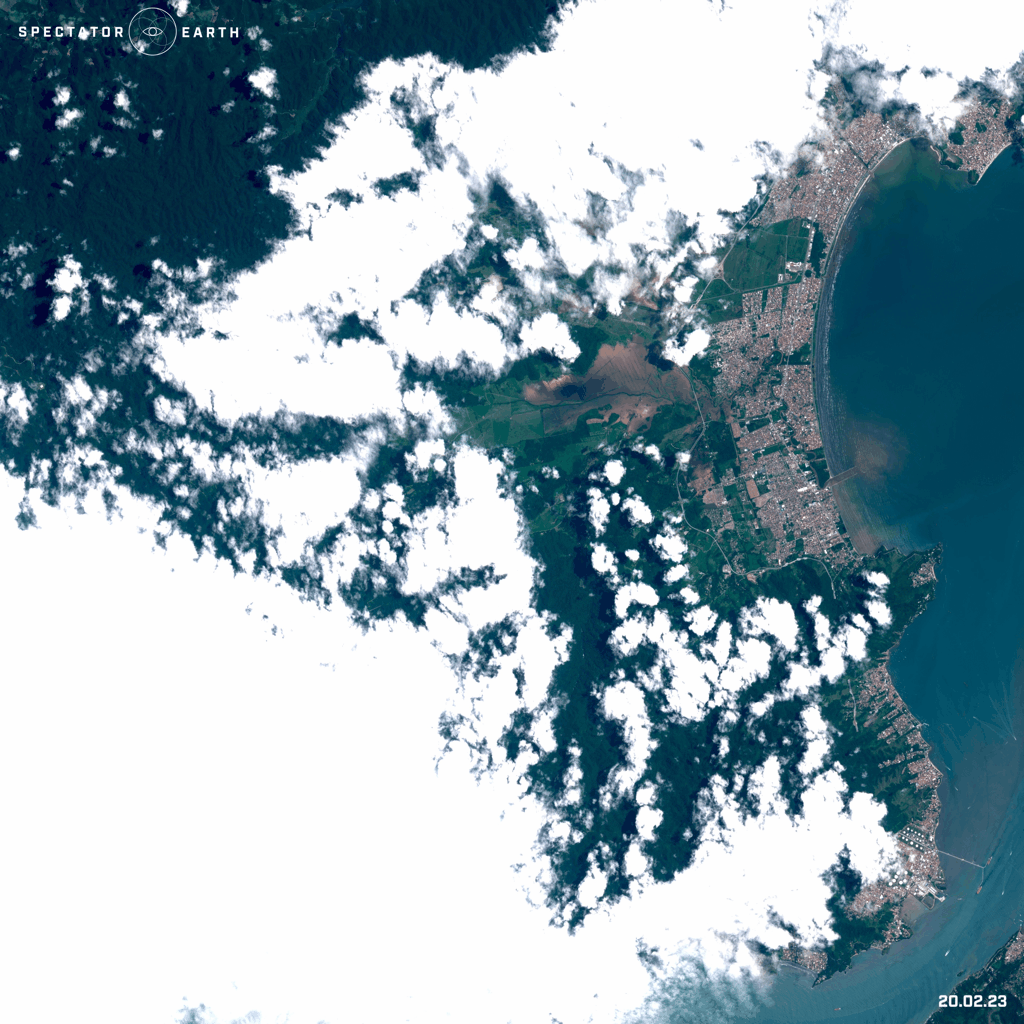
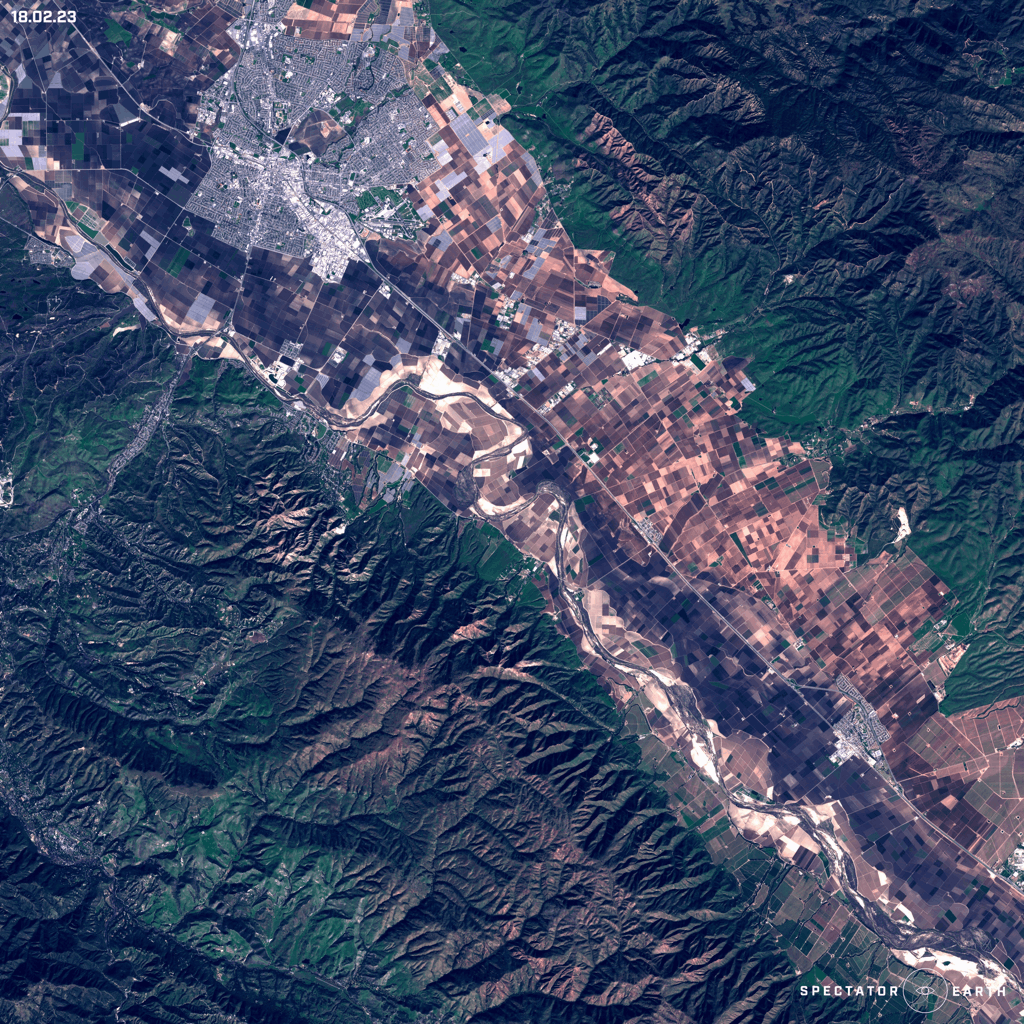
Another critical event that is becoming more frequent and severe is flooding. Climate change is causing changes in weather patterns, leading to more frequent and intense rainfall events. These floods can cause significant damage to infrastructure, crops, and human life. Below there’s an image of the state of São Paulo in Brazil, which was struck by severe floods by the end of February. Visible flooding also occurred in the Spence area in California, with the Salinas River overflowing.
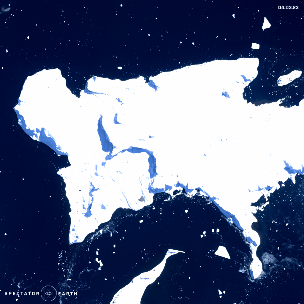
Melting Glaciers
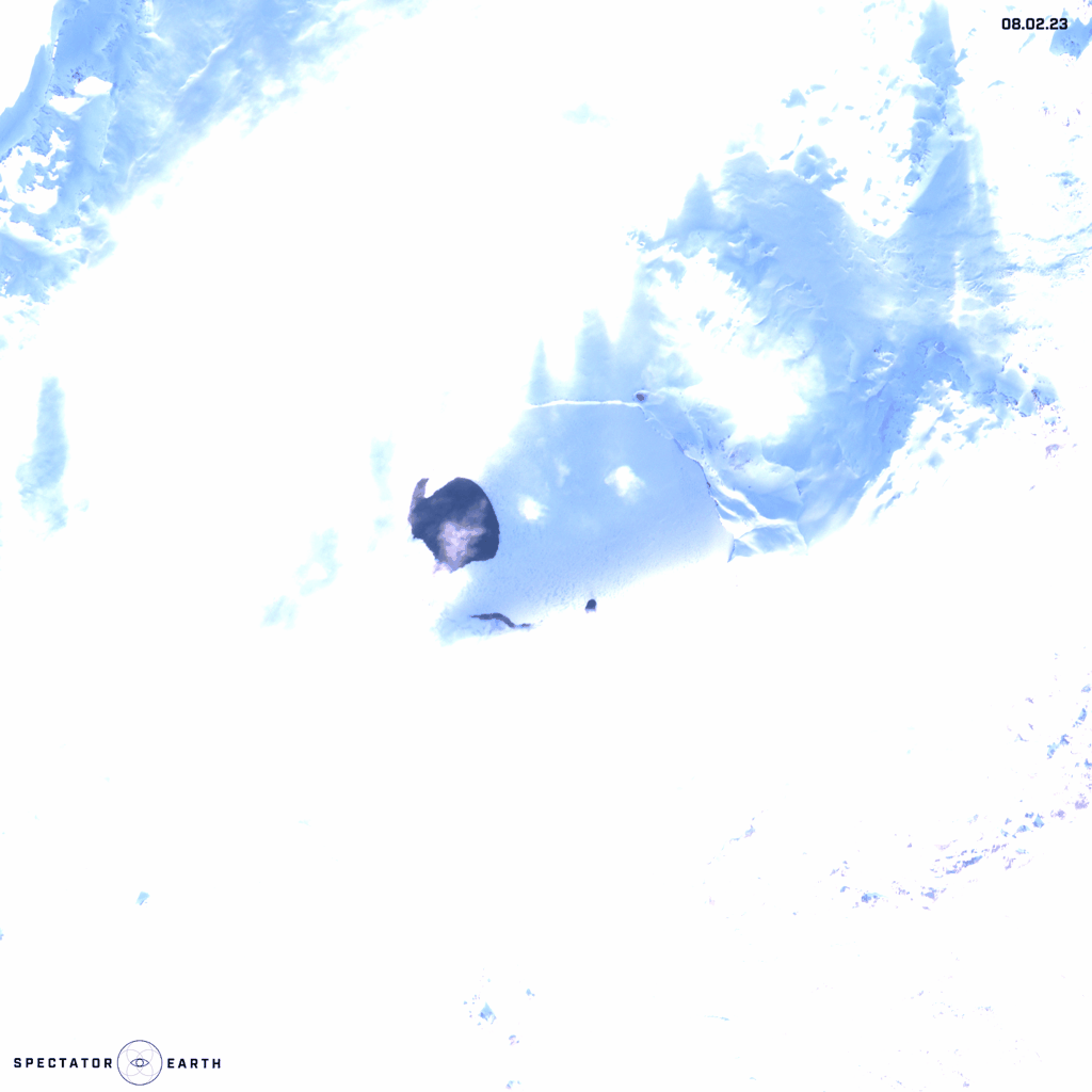
Satellite images are a powerful tool for monitoring the melting of glaciers. As global temperatures continue to rise, glaciers are rapidly receding, and satellite imagery provides an essential means of tracking these changes. By comparing images taken over time, scientists can measure the extent and rate of glacial retreat, which can have significant impacts on sea level rise, water resources, and local ecosystems. In the animations below, we can see the melting of Öskjuvatn Lake in Iceland throughout the March and melting of ice caps in Vega Island in Antarctica, where there has been a change in temperature in this region over the last few years.
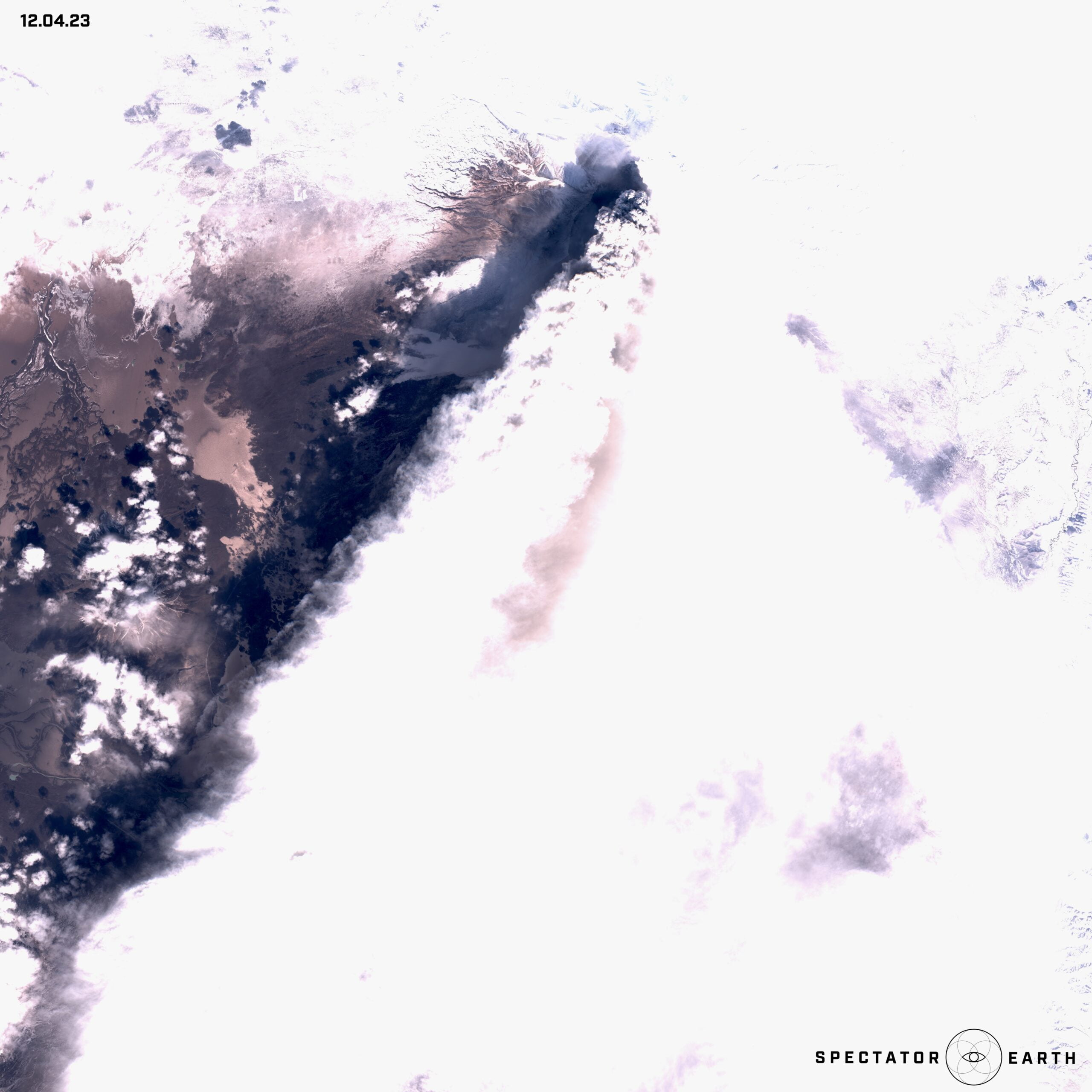
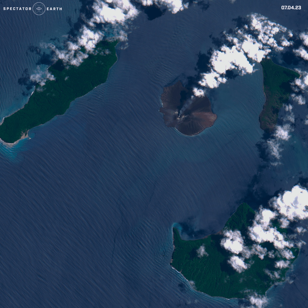
Volcanos
Volcanic activity is another event that can have a significant impact on the environment, including changes in the landscape and the spread of volcanic ash. The Shiveluch volcano, located on Russia’s Kamchatka Peninsula, has been exhibiting intense activity in 2023. Shiveluch is one of the most active volcanoes in the region, and its recent activity has caused many concerns. The activity began in early 2023, with a series of small explosions and ash emissions. However, the situation escalated in late April, with a powerful eruption that sent a plume of ash and gas several kilometers into the sky.
In April we could also observe the changing activity of Anak Krakatau volcano in Indonesia, presented below:
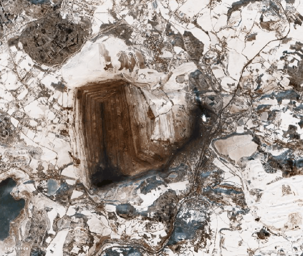
Open-source intelligence
Satellite imaging is an essential tool for OSINT since it allows for a safe and remote view of specific locations, infrastructure, and activities. In this instance, our focus is on the long-term advantages of utilizing satellite imaging, which include the ability to monitor certain locations and gather data over time. In an easy way, we can just observe the changes over time in our areas of interest, for example:
- Changes in the Bilina brown coal mine in the Czech Republic, visible throughout the last couple of years.
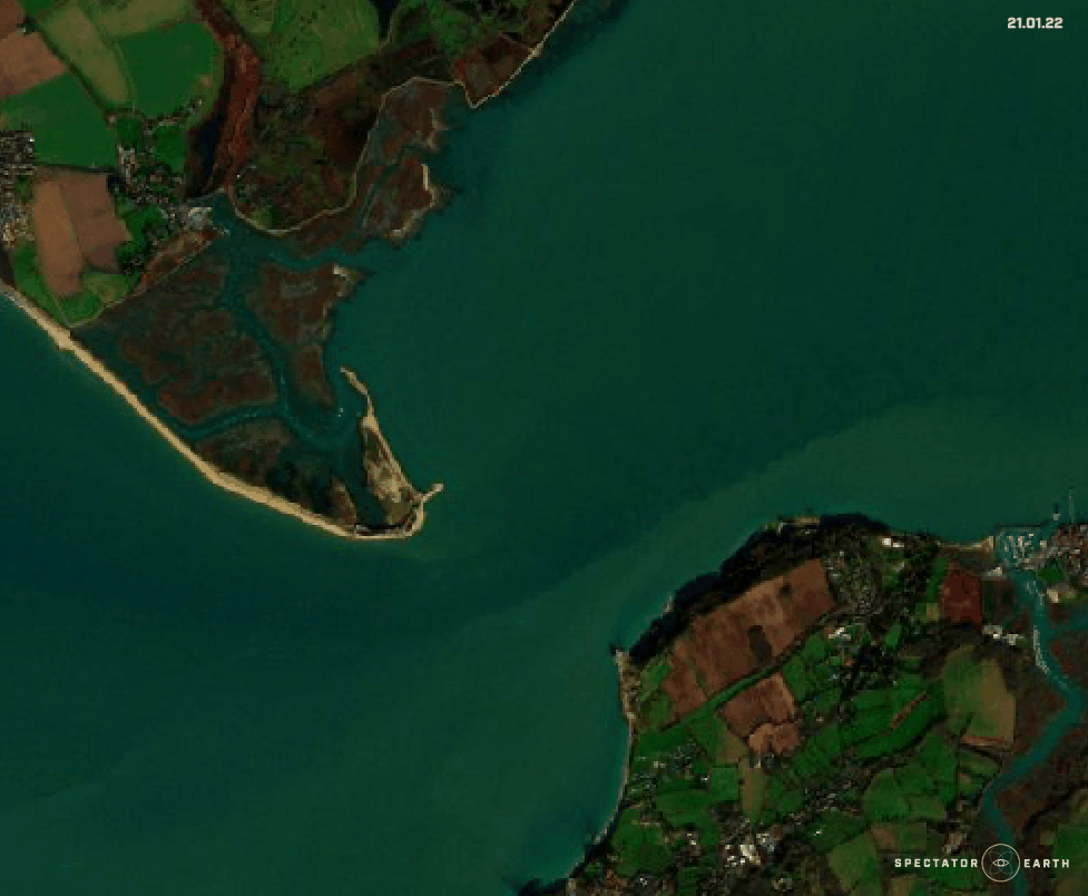
- Changes in the coastal line of Hurst Spit in the UK, with the visible shifting of the sand.
You can find the full list of observations highlighted in recent months here.