Highlights of most interesting observations in February 2023
Highlights of most interesting observations from February 2023
Satellites have revolutionized the way we understand our planet and the universe around us. They provide a bird’s-eye view of the Earth’s surface, allowing us to track weather patterns, study the environment, and monitor natural disasters. In this article, we will explore some of the best and most interesting satellite observations of February 2023.
Wildfires
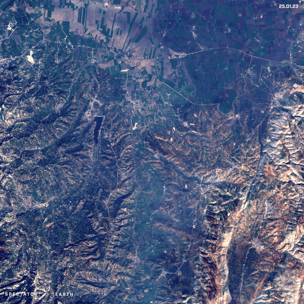
During February there were lots of ongoing wildfires happening in the Southern Hemisphere, such as:
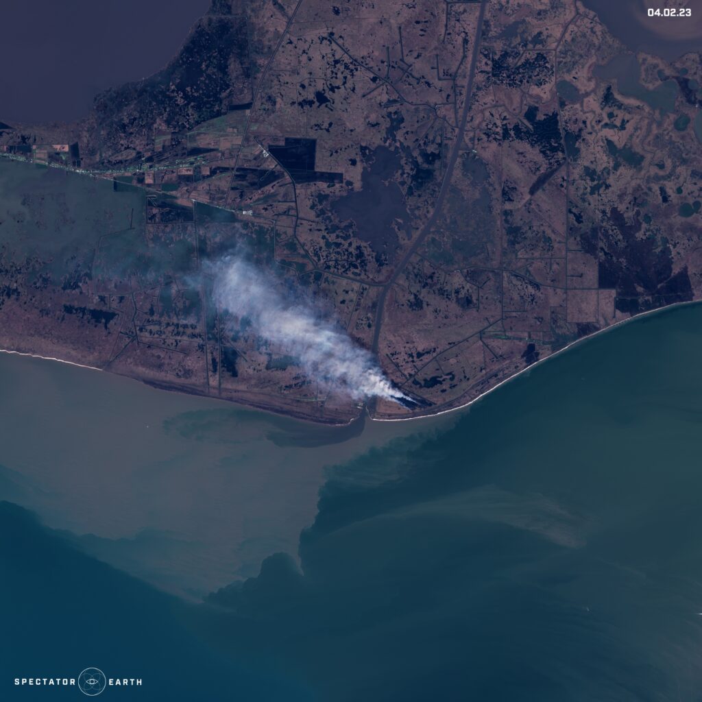
- A wildfire in Vermilion Parish, Louisiana, USA.
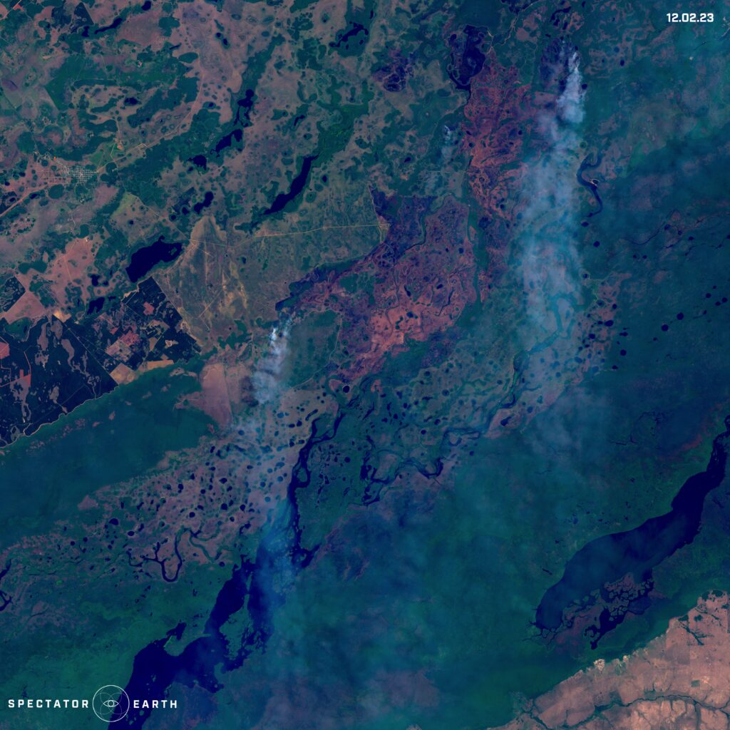
- A wildfire in Iberá National Park, Argentina.
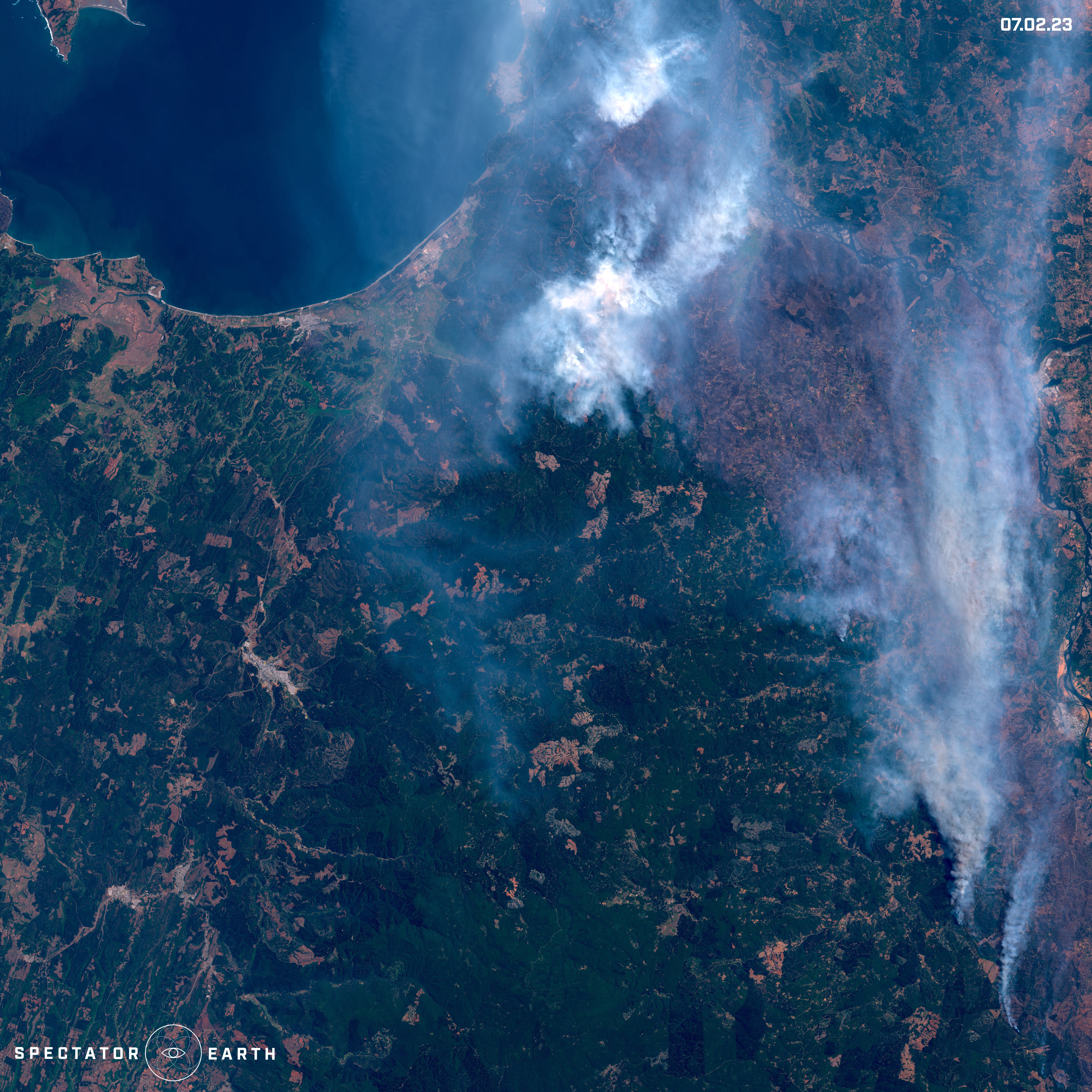
- Fires burning north of Angol, Chile.
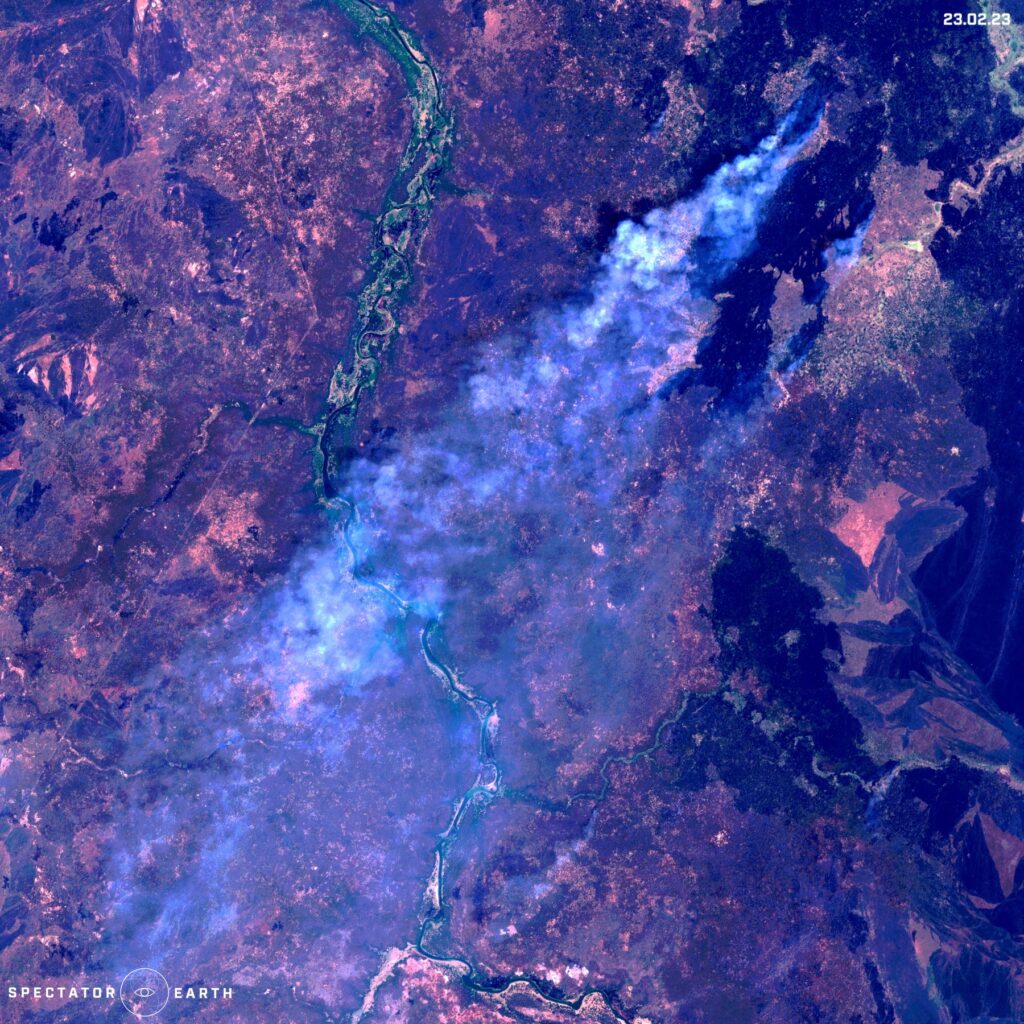
- A wildfire in Pibor, South Sudan.
Melting Glaciers
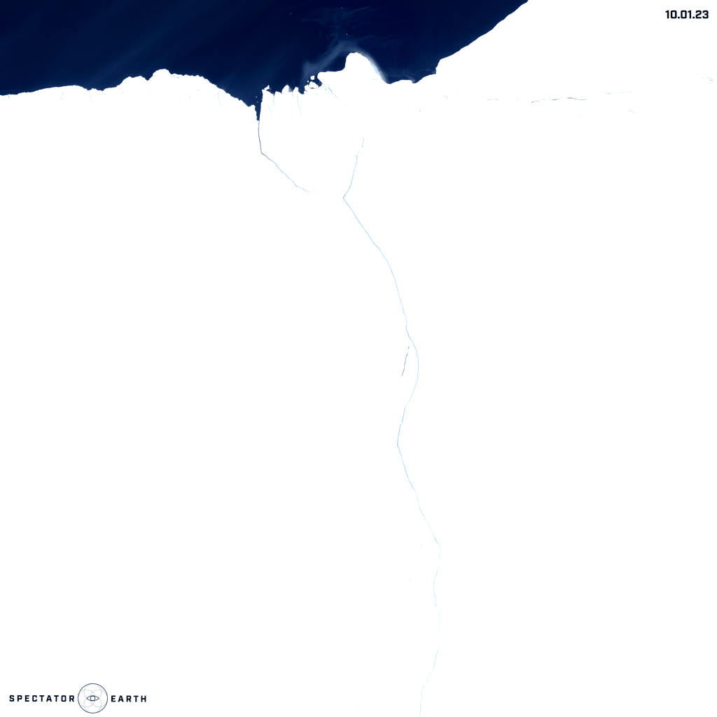
The melting of glaciers has significant implications due to its impact on increasing sea levels. Recently, the Brunt Ice Shelf in Antarctica gained attention due to a major event. This ice shelf is one of the world’s largest and plays a crucial role in controlling global sea levels by preventing large amounts of ice from entering the ocean. The following are the changes observed in January and February, including the separation of an ice cap.
Volcanos
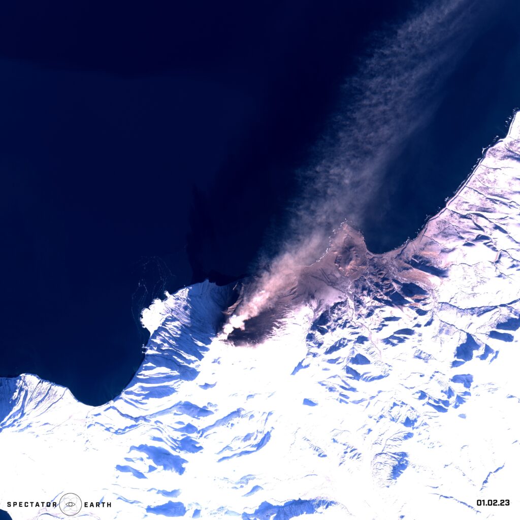
Satellite imagery has proven to be a critical tool in monitoring volcanic activity. Volcanoes are dynamic and unpredictable natural features that can pose a significant threat to nearby populations and infrastructure. Satellite imagery enables researchers to track changes in a volcano’s behavior, such as changes in gas emissions, surface deformation, and thermal activity. By analyzing this data, researchers can predict when a volcano may erupt and take necessary precautions to minimize its impact. In early February, we observed the activity of Chikurachki volcano from a satellite’s perspective.
Open-source intelligence
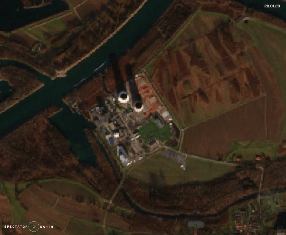
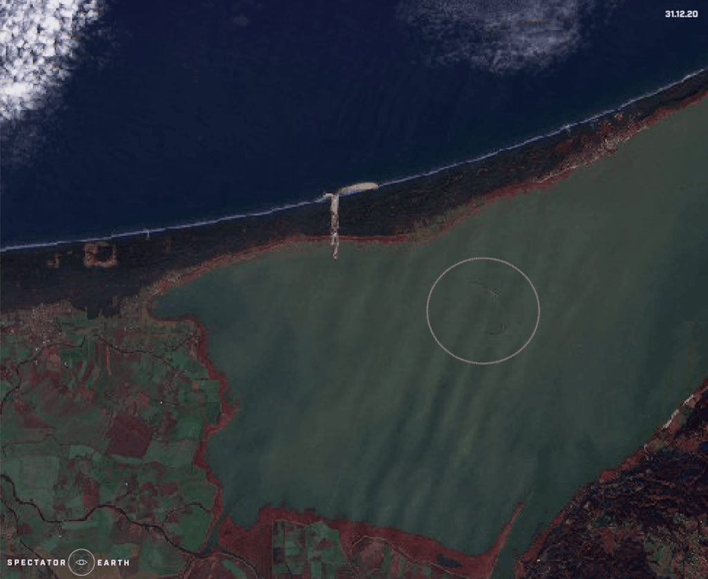
Satellite imagery provides valuable information that can support a wide range of open-source intelligence (OSINT) activities. By analyzing satellite imagery, intelligence analysts can identify patterns and trends, track changes over time, and gain insights that may be difficult or impossible to obtain using other methods. In this article, we focused on the capability to observe specific areas and gather information over an extended period, such as monitoring construction progress:
- Demolition of cooling towers in Phillipsburg Nuclear Power Plant.
- Construction of an artificial island – Aestian Island in the Vistula Lagoon.
Lastly, we observed the complex consequences of recent events. Following the earthquake in Turkey, the collapse of a dam in Syria caused the Orontes River to overflow, resulting in the displacement of the residents of Al-Tlul village.
You can find the full list of observations highlighted in recent months here.