Highlights of most interesting observations in January 2023
Highlights of most interesting observations from January 2023
The beginning of a new year came with many surprising events and new observations from the Earth’s orbit perspective. The observations used below are based on Copernicus Sentinel-2 satellites’ acquisitions. This time we focused mainly on using satellite imagery in monitoring and showing the whole process of construction of buildings all over the planet with additional events from environmental monitoring.
Wildfires
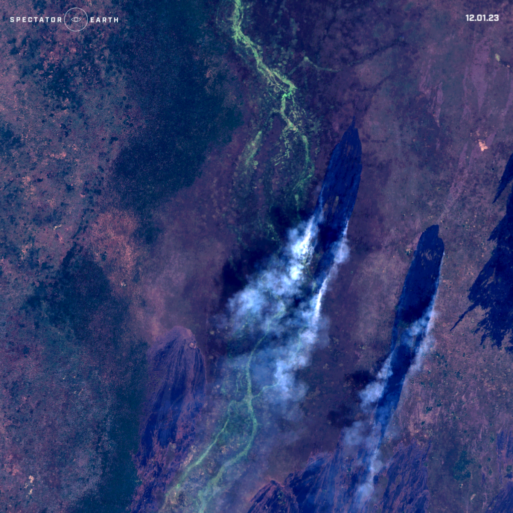
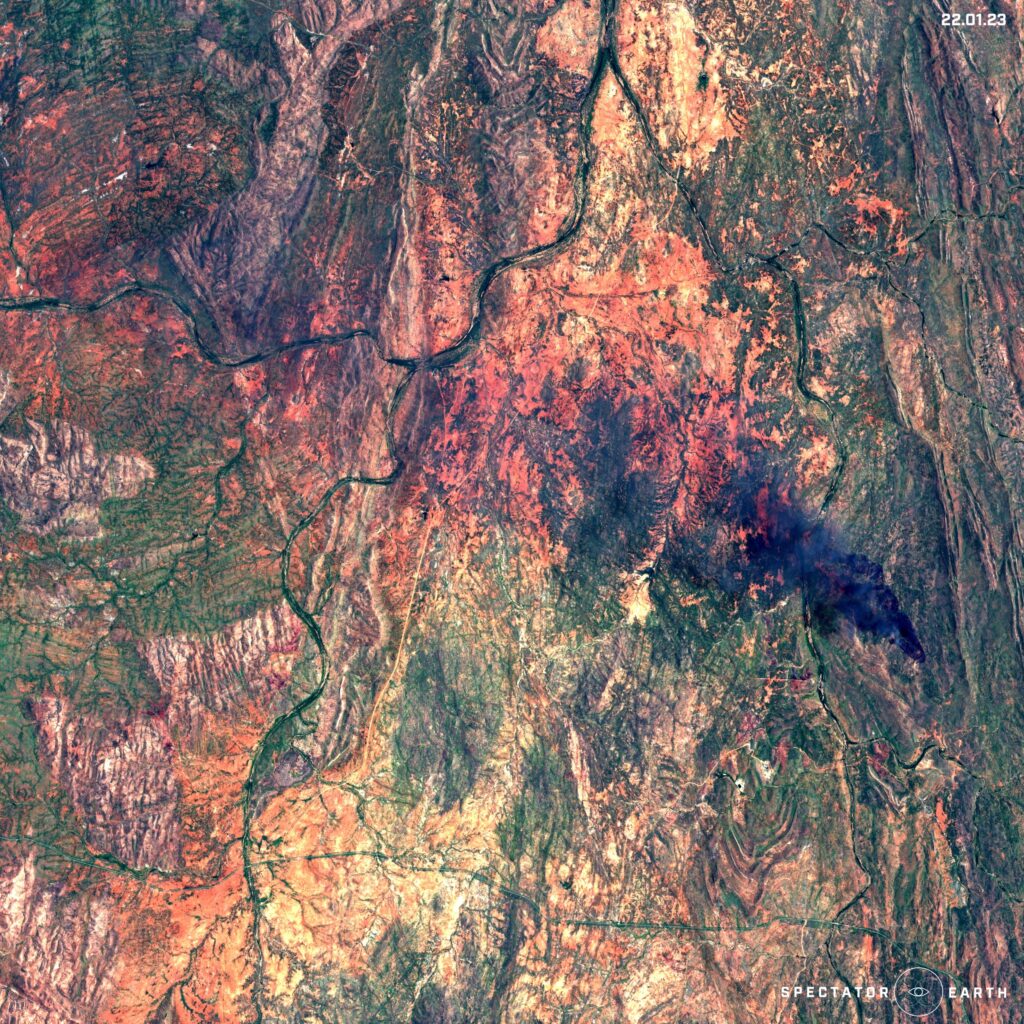
During January there are lots of ongoing wildfires happening in the Southern Hemisphere, such as:
- Wildfire spotted in Bailet County in South Sudan.
- Wildfire spotted in Mount Isa area in Australia.
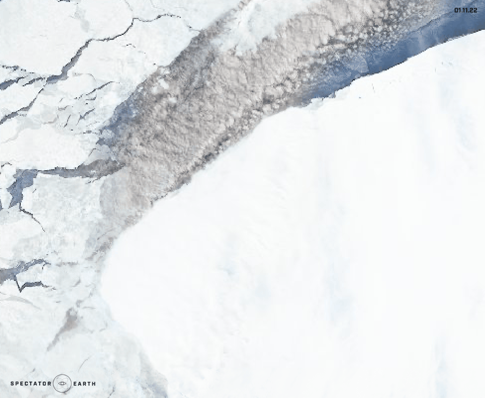
Melting Glaciers
Melting glaciers is one of the very important topics, due to the huge impact on the rising sea levels. This passing month one particular part of the Antarctic was a hot topic – The Brunt Ice Shelf. It’s a large floating ice shelf located in the Antarctic region. It’s one of the largest ice shelves in the world and is located on the coast of the Antarctic Peninsula. It’s also a very important component of the Antarctic region because it helps regulate global sea levels by holding back a large amount of ice from flowing into the ocean. However, by the end of January, an iceberg nearly the size of Greater London broke off the Brunt Ice Shelf.
Open-source intelligence
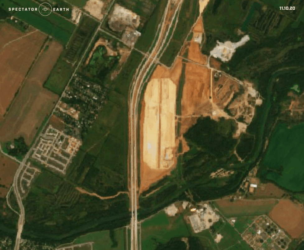
Satellite imagery provides a valuable source of information for OSINT, as it can provide a visual representation of a specific location, infrastructure, and activities, from a safe and remote vantage point. This time around we focused on the long-term benefit of using satellite imaging, which is the ability to monitor certain locations and collect data over the years. A great example of that would be observations of the construction process:
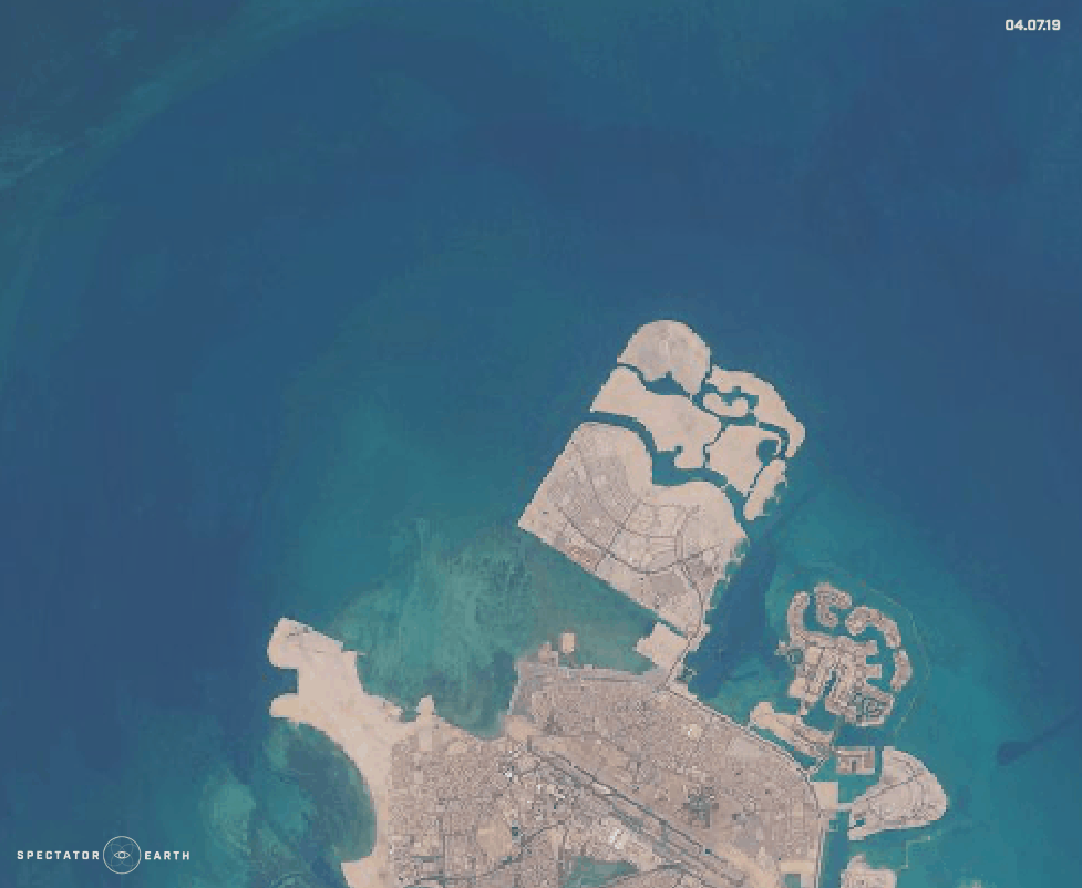
- Recent platform construction in the north of Bahrain.
- The construction of the Tesla gigafactory with over 10 million square feet of factory floor in Austin Texas, U.S.
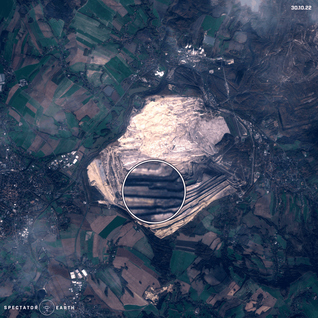
We can also use satellite imagery to observe the latest changes in the Turów Coal Mine in Poland:
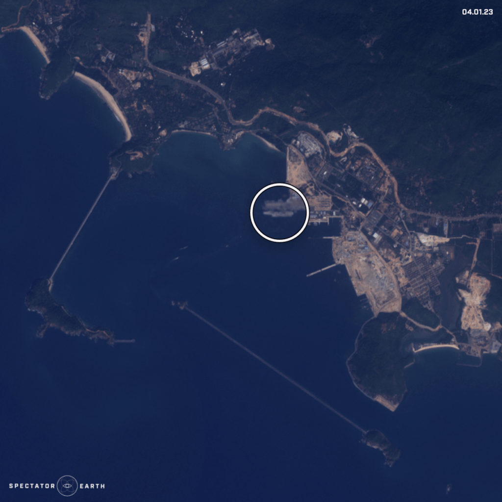
Or we can focus on IMINT and monitor locations like Naval Bases:
You can find the full list of observations highlighted in recent months here.