Wildfires, floods and volcanic activity – highlights of satellite observations from August 2022
Highlights of August 2022
Below you’ll find a summary of the most interesting satellite-based observations collected in August with the use of Copernicus Sentinel-2 satellites. The ongoing droughts all over the world are stretching water supplies thinner and thinner, while in other parts heavy rainstorms are causing devastating flooding at a scale that can be observed using openly available satellite imagery.
Season of heat
Scorching temperatures in August aren’t surprising, however, the rising number of wildfires spreading across the world should be. Beginning of August we could observe a fire that broke out in the Grunewald forest in Berlin, following an explosion at a munitions storage site. Moving on to North America, west of Polson in Montana, there was another huge Garceau Fire. In Australia, a fire was spotted near Bickerton Airfield on Bickerton Island. These are just some of the examples of what’s been happening in August.


Extreme droughts and flooding
During last month there have been many flash flooding events. Climate change is resulting in very polarized struggles in our environment. On one hand, we have a serious problem with droughts, on the other – we have heavy but short rainfalls, which are resulting in floods. Frequently talked about examples of flooding this summer, are floods in Pakistan. Whereas in the west it’s worth mentioning a flood in Death Valley. It’s an extremely dry place in California, where lately 3/4 of its annual rainfall fell in 3 hours. Both examples are very clearly visible from the orbit.

With extreme droughts all over the world, water levels have significantly reduced. A similar situation to the one happening in Lake Mead (which we talked about in our July summary) can be observed at Lake Urmia in Iran. Sentinel-2 images show the slow process of drying of the body water, which was once the sixth largest saltwater lake on the planet. This summer as China was suffering from the drought, the Yangtze River was running dry and still is because of the general water shortage in recent years.


Latest volcanic activity
Observations below are just an example of how we can monitor volcanic activity happening in every part of our planet. Not all the changes can be detected on satellite images. However, with low cloud coverage, we can try to measure such parameters as the length and surface area of volcanic gases during an explosion. Here you can see the Shiveluch volcano in Russia with a volcanic ash plume that rose up to an estimated 3,7 km and the activity of the Krakatau volcano.


Open-source intelligence
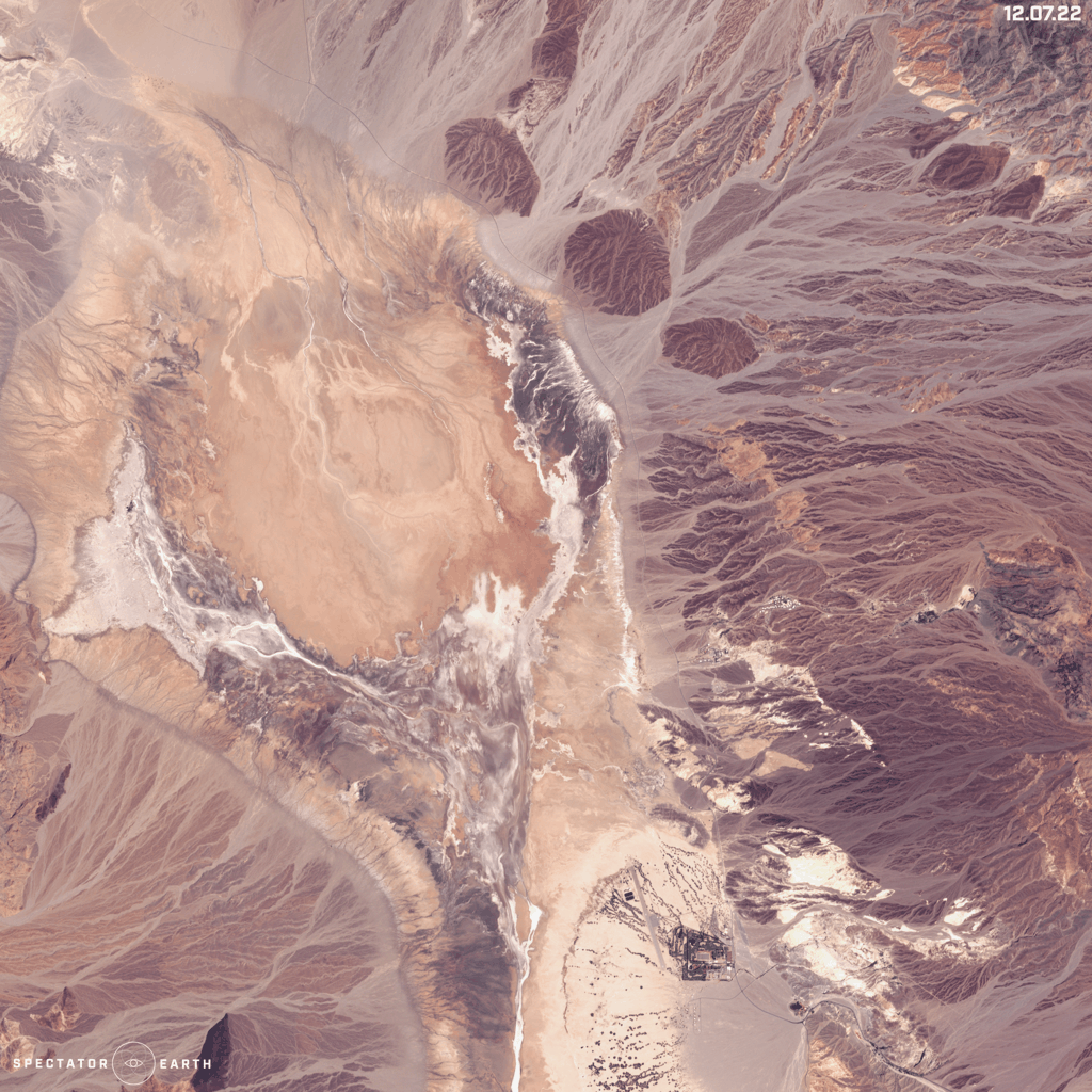
Satellite imagery enables us to follow many different situations and events happening worldwide. In August we could monitor fire in Energodar in the Zaporizhia oblast in Ukraine. Military activity over there is especially dangerous because of its close proximity to the Zaporizhia Nuclear Power Plant. Visible changes can also be noted in solar evaporation ponds in Lop Nur in Xinjiang, China. These mysterious rectangular shapes, all in natural colour, create the world’s largest potash fertilizer plant.

