Top satellite-based observations of May 2022

Highlights of May 2022

Here’s a summary of our observations from last month. Besides amazing views of beautiful places on our planet, we could observe heavy rainfalls in Queensland, melting glaciers or explosive volcano activity.


Images of relatively new Chengdu Tianfu International Airport. Because of the opening of the new airport, Chengdu became the third Chinese city to have 2 international airports – view on the map


Examples of the latest visible changes in satellite images

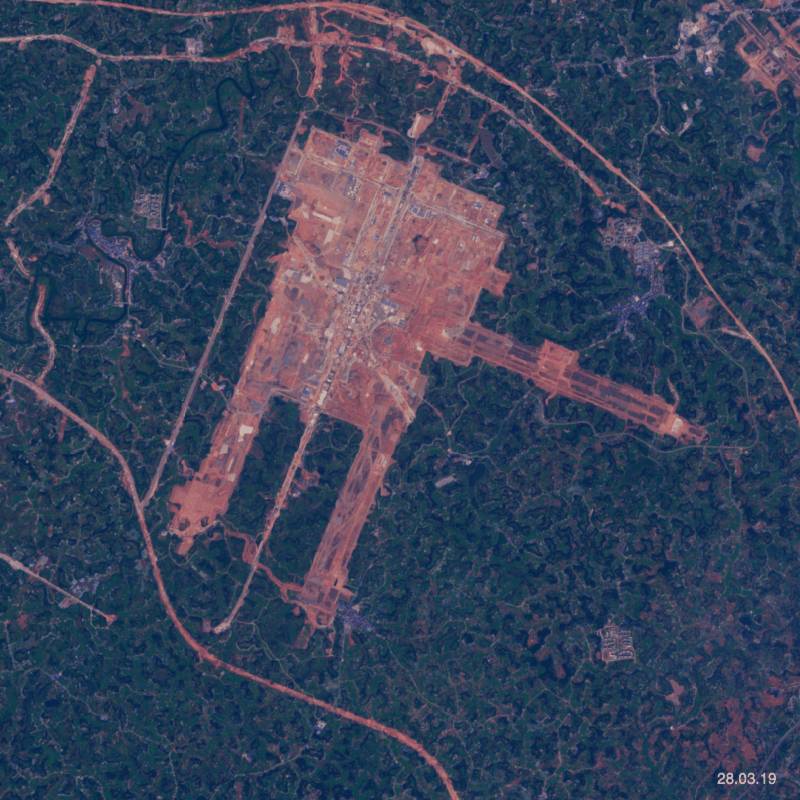
Satellite images allow you to monitor recent changes over the years. Above you can see the process of construction of the Chengdu Tianfu International Airport. Using our platform you can also choose certain locations and follow them in the future. For example, since mid-2021 U.S. defence officials have been claiming that China is considering whether to build a naval base in Equatorial Guinea and that all signs point to Bata. So this can be a great location to keep an eye on.

Port in Bata is the largest commercial port on the west coast of Equatorial Guinea – view on the map
Grand Prismatic Spring and its surroundings in Yellowstone National Park – view on the map
Between 16-18 April, the Manam volcano, located on Manam island erupted and its activity continues in May – view on the map
Image of the world’s biggest airport in Saudi Arabia – King Fahd International Airport – view on the map
How to obtain visible changes in satellite images

When you compare the satellite images, recent changes are even more visible. Such as the increase in glacier melting or in flood risk. It’s way easier to see these changes using animated images.

Throughout last month we could observe an increase in spring melting of Panmah Glacier – view on the map
Recent changes visible in Sentinel2 images of Mariupol in Ukraine – view on the map
Heavy Rainfalls occurring in Mourilyan in Australia – view on the map
View of Lake Eyre – when seasonal rains are plentiful, the water body is Australia’s largest lake – view on the map
Picture of the coast of Belize, which is known for having the largest barrier reef in the northern hemisphere – view on the map
The beautiful coast of Umm al Qaiwain – the least populated of the seven United Arab Emirates – view on the map
Colourful area near Bari – the second biggest city in southern Italy – view on the map


Fires spotted near Sievierodonetsk in Ukraine on May 8th – view on the map


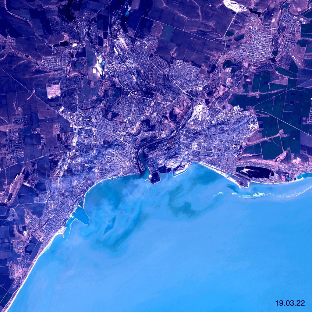
Monitoring conflicts using satellite imagery

Satellite imagery enables us to follow the course of action and current situation in Ukraine. Intense fighting continues especially in the eastern and southern parts of the country. Russian forces now control more than two-thirds of the key eastern Ukrainian city of Sievierodonetsk.